Rim to Rim to Rim in 2 Days - Prep Notes
On May 22 and 23, I hiked the Grand Canyon rim to rim to rim (R2R2R). Here are my notes on planning and preparing for that incredible and challenging experience!
Please leave a comment if you find this information helpful or if you have any questions!

Training
The best way to train for a really long, challenging hike is to do really long, challenging hikes. I firmly believe that it’s necessary to build up to 15-20+ mile hikes on a regular basis before you attempt rim to rim to rim. Other training modalities do carry over into hiking, but there is nothing that replicates the pounding, climbing, stepping down, etc involved in hiking. Caluses build up over time and prevent blisters. Your stability and balance improve as you hike. You become mentally accustomed to exercising for hours on end. These are all important elements to preparing for a hike like rim to rim to rim.
My baseline fitness regimen is doing Crossfit 5 days/week. 8 months prior to our hike I started training on the trail. My first hike was ~6 miles and I quickly built up to the point where I hiked 15+ miles every 2-4 weeks, making sure to have a handful of 20+ miles under my belt. Training hikes were done on trail that had comparable elevation gains as the North/South rim. Carry slightly more than the weight you anticipate carrying for rim to rim to rim every single hike. Do at least one “simulation” of rim to rim to rim where you hike 2 days back to back. Do this at least 6 weeks before your actual hike - it takes a while to recover! We did 20 miles and 11 miles and I feel that was enough to simulate the feeling of waking up on day 2 and hiking on feet/legs that just completed a really long hike the day before.
Additionally, about 1 year prior to the hike I began to follow a squatting program that includes lots of heavy squats as well as weighted lower body accessory work that dramatically improved my overall strength, single leg strength and stability and stabilizer muscles. In case you’re interested, it’s called ThundrBro - Muscle Anarchy. I think any squatting plus accessory work program would be sufficient.
Taper all physical activity 1-2 weeks prior to your hike. Be extra careful to avoid injury for about 8 weeks prior.
For me, R2R2R was hard but manageable and I attribute that to my preparation. I had no blisters, no strains, no joint issues etc.
If you live in the GA/TN Area, see appendix with a list of great training hikes that I did (there is no shortage of them).
Timing
The most important factor in determining the timing of your trip should be weather. Securing lodging is the most important logistic to sort out. North Rim lodging is only open May 15 - October 15.
We hiked May 23 and 24, 2021. In my opinion, the earliest possible date in May is best. Just one week after our hike, temps in the canyon were 10+ degrees higher. Of note, it’s cold at the rim early in the season, but due to the lack of humidity it didn’t feel very cold to me at all.

Weather
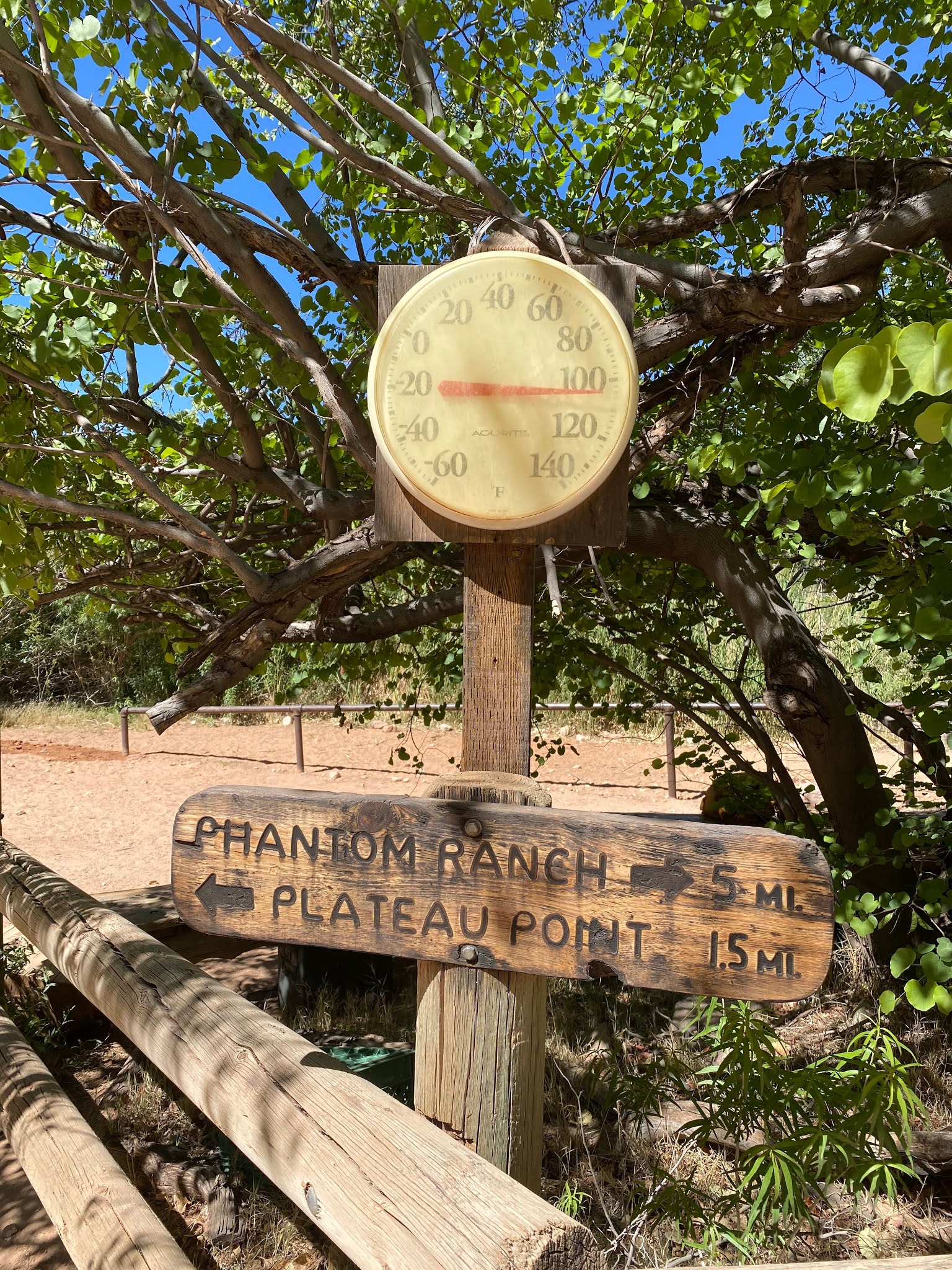
South rim starting temp was 28 degrees. North rim starting temp was 34 degrees. Canyon high temp was 110. I quickly warmed up and wore coat/gloves for about 1.5 hours only.
It was very windy with reported gusts up to 40mph.
Weather can be checked at the following sites (be sure to check both):
Phantom Ranch weather:
https://www.nws.noaa.gov/wtf/MapClick.php?site=fgz&textField1=36.1050&textField2=-112.0940&lg=ep
Rim weather:
https://www.weather.gov/fgz/GrandCanyonRecreationalForecast
Lodging
R2R2R Lodging should be booked as far in advance as possible.
On the South rim, the most convenient lodging is inside the National Park (Bright angel lodge, Yavapai Lodge, etc). I would highly recommend staying in the park the night before your hike since it takes ~25 minutes to get inside the park from any lodging that is outside the park. We stayed at Yavapai Lodge. There is coffee in the room. There is a mini fridge. There is also a grocery next door where you can purchase items for breakfast etc. Shampoo, conditioner, soap etc available in room.
Yavapai lodge:
On the North rim, the most convenient lodging is the Grand Canyon Lodge North rim. Reservations typically open on January 15 at a certain hour (something like 10am) of the year of travel. I logged in about 15 minutes early and was able to book. Also try to call at the same time. It’s critical to get a booking here since the other nearest loding is ~20 minutes away. One thing to note is that the Grand Canyon North rim lodge is 1.7 miles from the North Kaibab trail head. There is typically a shuttle but due to COVID-19 there was no shuttle operating for us so we had to walk this additional mileage. I spoke with an employee who was operating the on site golf cart shuttle and he mentioned some employees were willing to unofficially shuttle to the trail head for $20 but we started too early for them. No coffee in the room. Maybe bring an instant coffee packet and mix with hot tap water if you are a hard core addict like me. The deli might sell bottled coffee/caffeinated drinks. There is a mini fridge. Cabins are fairly bare bones but the shower is nice and there are shampoo, conditioner, soap.
North rim lodge:
https://www.grandcanyonforever.com/

Inside North Rim lodge Pioneer Cabin
The evening of day 2 (after we were all done hiking), we left the park and stayed at the Red Feather Lodge outside the park. Some restaurant options nearby. We opted for drive thru Wendy’s because we were so exhausted. Ask for a room inside the main building or for a 1st floor room if in the secondary building if you don’t want to have to take the stairs!
Red Feather Lodge:
https://www.redfeatherlodge.com/
Parking
For the R2R2R, we parked our car close to the Bright Angel trailhead in between the Maswik Lodge and the Bright Angel trailhead (there is a small lot just off the right of the one way road leading from trailhead to Maswisk lodge). Rangers will tell you only to park in the official lots (Lot D for example) but also indicated to us that there is no repercussion for parking elsewhere. The place we parked was a bit closer.
Map of parking (see hand drawn red arrow to approximate location):

Park Access
You need to pay park entrance or have an annual pass to enter the park. Park entry is open 24/7.
R2R2R Equipment/Packing List
Some of these items are mentioned in other sections but here is my complete packing list:
- Hiking pack (I used the REI Traverse 35 and it was the perfect size. If you are buying a new pack, you should go to REI and get fitted - there's no good way to know whether a pack will fit your body without trying it on. Train with this same pack - do not wear it new.)
Head lamp with batteries (we started in the dark so we definitely needed this but park rangers and experts recommend you carry one, regardless)
Extra head lamp with batteries
Compact disc - reflects sun and creates a beacon if you need rescue - very light so you might as well
Reliable hiking poles
Snacks for day 1 and 2
Electrolytes
Extra pair of shoes - this was annoying but necessary, I suppose. I took my boots off enough that I guess they could have fallen off a ledge or something. I brought tactical tennis shoes (5.11 brand) that I routinely exercise in
Small zinc oxide sunscreen STICK (sticks are much lighter than liquid - they also don’t run when you sweat like liquid). Due to my long sleeved shirt I only needed coverage on hands and face. Keep this handy and reapply at every break during afternoon hours.
https://www.beautycounter.com/product/countersun-mineral-sunscreen-stick-spf-30
I used this brand and got zero sunburn
Polarized sunglasses - you can sunburn your eyes. Wear these during all sunny ours.
Small deodorant
Small toothpaste
Toothbrush
Contact lenses
Chap stick with SPF
Face moisturizer sample foil packs
Hair tie
Cell phone charger (you will need to block part because north rim does not have USB charging plugs)
Cell phone
GPS or other device you opt to you plus charger
ID and credit card for hotel/food purchases/phantom ranch purchases
Hiking pack with hydration bladder
One empty, disposable water bottle
Clothing items and footwear mentioned below
Over the counter pain medication - this was nice on day 1, necessary on day 2 (please do your own research/discuss with your medical provider which medication is most appropriate for you)
Cash (Deli at N Rim lodge is cash only - there is ATM on site but we ddin't want to fool with that bc we were so exhausted)
Water treatment supplies in case water lines burst - this does occur and the supplies to treat creek/river water should not be omitted
Leave behind anything you don’t need to carry back on Day 2 (toothbrush, toothpaste, extra snacks, etc)
R2R2R Hydration
Use a camelbak or other hydration bladder. You need to continuously sip water and will not want to have to reach for your water bottle every time you need to do this. Also carry 1 empty disposable water bottle (they are light) to mix electrolyte solutions in.
There are lots of water sources along the Bright Angel and North Kaibab trails, assuming they are all functioning. The longest stretch with no water is 7.2 miles. You can plan how much water to carry for each stretch based on how far it is to the next water source and what time of day (how hot it is). I typically carried 1-2L in my camelbak and, during the afternoon, also carried one water bottle full of electrolyte solution. At each water source we visited during the afternoon hours, I mixed and chugged an electrolyte solution and then made another for the road.
I used more electrolytes than I thought I would. I would recommend bringing at least 6 per day. (3 chugged bottles plus 3 bottles for the road in the afternoon hours). I purchased 2 with caffeine for an additional boost but doubt you would want all to contain caffeine. Make sure you drink enough to pee every 2-3 hours.
I highly recommend purchasing lemonade at Phantom Ranch. It’s $5 for the first cup and $1 for a refill (I had 2 cups full on day 2). You can request half lemonade and half tea and it’s delicious. There are some snacks there but no real food to speak of so do not count on that.
As mentioned in the packing list, water pipes do burst and it's possible you will need to treat water. Bring appropriate supplies/containers to do so.
Link to check the status of water stations:
https://www.nps.gov/grca/planyourvisit/trail-closures.htm#CP_JUMP_1941213

Nutrition on and off the Trail
Training will help you learn how much and what you like to eat when you hike. I used a fitness app during training which approximated calories burned during a 20+ mile hike and found those estimates to be around ~3800 calories. Figuring that I would eat breakfast and dinner off the trail, I packed 2800 calories of snack per day. 47% carbs, 36% fat, 17% protein. This is about double what I actually consumed on any training hike. You can download the free version of “My Fitness pal” and scan food barcodes to total calories and macros.
I packed snacks for day 1 separately from day 2. This was helpful (explained below).
I found myself much more hungry and eating much more than on any training hike I did so I was thankful for the extra food I brought. I think it’s important to eat well since this is a 2 day hike versus a 1 day hike, like many of my training hikes. If you get depleted on day 1, it will affect your day 2 performance.
After day 1, I had some snacks left and removed almost the same amount of snacks from my pack for day 2 to avoid excess weight. That being said, I found myself even more hungry on day 2 so I wouldn’t remove ALL the extra snacks from day 1 from your day 2 pack.
Recommended snacks: It’s important to have salty snacks for electrolyte intake.
Chomps meat sticks
Peanut butter pretzels
Apple sauce packet (eat first since they are heavy)
Tortillas
Tuna packet and mayo packets (eat on tortillas for lunch)
ProBar
~2 energy gels per day (used on the final push for an energy boost)
Your protein bar of choice - don’t go low carb
Gummy bears - these are great to have easily accessible and to grab a few every so often
Peanut butter crackers

South Rim food: Due to COVID-19, options were limited but we found some dinner in a “food court” in the park. I bought a high calorie oatmeal cup in the grocery store and made it in the hotel room with hotel water from the coffee pot for breakfast. There was also coffee in the room but I bought a starbucks coffee drink from the grocery the night before.
North rim food: Due to COVID-19, options were very limited. There is a full service restaurant which requires reservations to get seated. We opted not to make a reservation because we did not know when we would finish and doubted we would want to sit in a restaurant after all day hiking. The restaurant was supposed to serve to go food from the hostess stand but was short staffed so they were not doing this. There is an on site deli that was sold out of everything except 2 types of sandwiches so this is what we had for dinner. Deli was cash only. There is an onsite ATM. I saved half my sandwich and ate it cold/soggy for breakfast the next morning. The food was sufficient but disappointing. Something to be aware of. Also, gift shop, etc were closed early. As mentioned earlier, no coffee in the room either. We started hiking too early in the morning to access any lodge concessions.
R2R2R GPS/Navigation
We used a Garmin InReach mini GPS unit. The main purpose of this was for friends and family to be able to follow along and, for that purpose, it worked extremely well. My mom reports following us every step of the way and being able to see so much detail that she could tell where we stopped for each break, where we parked our car, etc. This device has the capability of pre-programming 3 outbound messages such as “we started” and “we finished” that can be sent to pre-selected recipients. It seems like the messages were sent but not necessarily in real time. This unit did not do a good job of tracking mileage. It was off by about 10 miles.
The STRAVA fitness app did a great job of tracking miles and creating a “screen shot-able” snapshot of the route/distance/elevtion gain/etc.
Navigation devices are not needed on these trails. There are few junctions with other trails, and those are well marked. The trail itself is well-worn and wide and there was never a question of whether we were on the correct trail. If you study a map ahead of time, that is sufficient.
It was also helpful to have a screen shot of a trail map with water stations/miles notated on the cell phone so that we could confirm how many miles the next water station would be.
Trail map with water stations/miles notated:
http://npmaps.com/wp-content/uploads/grand-canyon-hiking-map.jpg
STRAVA example:

R2R2R Clothing/Staying Cool/Sun Protection
I wore or carried the following:
Long, breathable, light colored pants
Short sleeved lululemon shirt. Removed when it got hot.
Long sleeved Patagonia sun shirt WITH HOOD (I never took this off and it was incredible for sun protection - the hood is essential to protect your ears, neck, sides of face). At each water stop during the hot hours, I removed shirt, soaked in water and put it back on sopping wet - kept me cool for 30-45 minutes afterward. I would highly recommend doing this every chance you get.
https://www.rei.com/product/165053/patagonia-capiliene-cool-daily-hoodie-womens
REI 650 Down coat for cold hours (very warm and very light to pack)
Lightweight gloves can be worn in cold hours and also in the sun for sun protection on your hands - recommend white/light colored gloves for this
3 pairs of hiking socks (I used all 3 each day- sock changes were a great relief). I had one pair that was thinner than the others and preferred this pair the least. Thick, “Darn Tough” brand were my favorites.
Well broken in hiking boots
Baseball cap with big bill
Light tshirt/shorts to sleep in
I brought one pair of clothes for both days to avoid excess weight. If you like, you can rinse/soap clothes in the shower at the end of day 2. It’s so dry that they will dry overnight if you wring them out well. Socks can be reworn as well. Just shake them out at the end of day 1.
My hike “uniform”:

R2R2R Route, Timing and Rest Breaks
We took Bright Angel trail from the South Rim to the North Kaibab trail to the North Rim and followed the same route back. We selected this route because the Bright Angel trail is less steep, although ~3 miles longer, than the South Kaibab trail. You will need to pick one route to complete for both days since South rim trailheads are not within walking distance. I would recommend this route because you will be the most fatigued on te Day 2 South rim ascent and the less steep route felt much more achievable, to me.
Bright Angel trail: Elevation change from rim to river is 4460 ft (1360 m)
North Kaibab trail: Elevation from rim to river is 5850 ft (1780 m)
Official map mileage: 46.2
Fitness app mileage: 53.9 (we walked 3.2 miles round trip to North rim lodge)
The easiest part of the hike was the first half of day 1. The first ~10 miles are downhill, easy and so beautiful that it’s hard to believe the hike will be a challenge. For better or worse, this was a blissfully ignorant phase of the hike.
The most difficult part of the entire hike for me was the North rim ascent (about the last 5-7 miles of Day 1). This section of trail is incredibly steep, sometimes narrow, and without much shade at all. You’re also completing it in the heat of the day. It was very physically, mentally and emotionally challenging and required many breaks, electrolytes, snacks, and mental pep talks. The 0.6 miles leading up to Supai tunnel are the most difficult. The 2 miles from Supai tunnel to the finish are incredibly slow and difficult as well.
The most fun part of the hike was the section between Phantom Ranch and Cottonwood on Day 1. Lots of hikers are coming down from the North Rim and saying hello and it’s a really beautiful stretch of trail with the creek running alongside it.
There is a side trail to Ribbon Falls. We opted not to take this and add mileage but I’ve heard it’s beautiful. There is a distant view of the falls from the North Kaibab trail.
We started hiking around 3am on both days in order to allow plenty of time to finish before dark. I didn’t mind hiking in the dark but realized after the fact how sheer the drop offs from the trail were. It’s possible we would have moved faster if we had more light when we started. On Day 1 we finished around 5pm and on day 2 we finished around 6pm. So, day 1 was a 14 hour day and day 2 was a 15 hour day. We walked at about 2.3 miles/hour but took plenty of breaks that were long enough to use the bathroom, eat a snack, drink electrolytes, change socks etc. Our fitness tracker told us that our breaks added up to about 2 hours total each day.

At each break, I took the time to do 3-4 different stretches for several minutes each (I was having some back pain prior to the hike and this was very helpful). I also made a point of elevating my feet ABOVE the level of my heart for at least 90 seconds. This usually meant lying down on a bench and putting my feet up in the air. I’m sure I looked ridiculous but it felt good and my legs and feet felt fairly fresh for all of day 1. Stretch morning and night as well.
Taking my boots and socks off me to stretch my feet and ankles and seemed to take some pressure off. I changed my socks at about half way and once more on the ascent each day since they were feeling damp. Clean, dry socks felt amazing to put on.
At times during the second half of both days I felt dizzy and/or nauseated. Taking a small break to eat something salty and drink electrolytes seemed to help. I don’t think you should “power through” feelings like this. Take the time to stop and address it so it doesn’t get worse. On Day 2, early in the day (before it was hot) I was also feeling dizzy and nauseated with a headache. I felt like eating sugary snacks and drinking sweet lemonade/tea at Phantom ranch finally improved these symptoms. When in doubt, eat and drink something even if you feel nauseated.
You can count on pain/inflammation and this may be easier managed by preventing it rather than trying to get it under control once it’s already there. Do your own research and speak with your medical provider to determine what medication/dose is safe for you to take. It's important to be aware that it's likely some level of dehydration will be present and could make common medications less safe to take.
Random tips
There is no trash disposal along the trail so all trash must be packet out. Take the opportunity at the North Rim lodge to dispose of trash/excess items.
Squirrels in the Grand Canyon have the plague and are aggressive and can bite. Avoid them and watch your pack very closely when you break - they will try to take your snacks!
Visit the “Backcountry Information Center” inside the park the day before you hike. Tell the ranger your plans and ask questions. They were very helpful.
Make friends along the way! There were lots of people ascending the South rim when we were and it was a welcome distraction to chat with them along the way/at rest stops. It was also helpful to recognize them ahead of me on the trail so I could visualize where I was headed.
Visit the Bright Angel trailhead the day before, especially if you will start hiking in the dark, so you know how to locate it.
Diana Toney
Appendix: GA/TN Training Hikes (listed in order I completed them from October 2020 - April 2021 to train for R2R2R)
10/8/2020: Blood Mountain and Freeman Loop Trail 6.2 miles
10/13/2020: Stones Mountain Walk up trail x 2 plus Cherokee Trail, 7 miles
10/25/2020: Arkaquah Trail at Brasstown Bald, 11 miles, elevation gain 3,713
10/31/2020: Sweetwater Creek State Park White and Yellow Loop, 8.2 miles
11/7/2020:
11/22/2020: AT Approach Trail: Amicalola Falls to Springer Mountain and back, plus the Hike Inn Trail, plus the Amicalola Fall stairs (up and down from parking lot), 17.41 miles, 4,160 elevation gain
11/29/2020: Urban hike on South Peachtree Creek trail in Decatur, GA, 8.2 miles
12/6/2020: Kennesaw Mountain Battlefield Loop (not sure of official trail name), 10.94 miles, 1,288 elevation gain
12/19/2020: AT Woody Gap to Neely Gap to Woody Gap, 21.32 miles, 5,727 elevation gain
1/3/2021: Coosa Backcountry Tail plus some Duncan Ridge Trail and Bear Hair Gap Trail, 15.05 miles, ~3800 elevation gain
1/4/2021: Raven Cliff Falls Trail, 4.96 miles
1/16/2021: Fort Mountain State Park - Gahuti Trail loop x 2, 16.2 miles, 4,390 elevation gain
1/30/2021: Sawnee Mountain Park - Indian Seats Trail Loop plus extended West Loop, 9.39 miles
2/20/2021: Sweetwater Creek State Park - White, Green, Orange and Blue loops, 12.87 miles, 1,554 elevation gain
3/13/2021: AT Woody Gap to Cooper Gap and back, 16.05 miles, 3,190 elevation gain
4/18 and 4/19: “Simulation weekend”
Day 1: Benton Mackaye Trail - Skeenah Gap Road to Toccoa Swinging Bridge and back - 20.4 miles, 5,656 elevation gain
Day 2: Jacks River Trail - 10.94 miles
I think I missed a few but you get the idea!

I'm impressed!
ReplyDeleteCongratulations! Thank for sharing.
ReplyDeleteCongratulations! Thank for sharing.
ReplyDeleteWow this was great. I'm looking to go back and do the N2S trail, but when I attempted it 4 years ago, I dehydrated and had to be helicoptered out. I trained for 9 months and was so ready, but the weather at night was in the 40's and during the day it was 115 in the canyon during the day and nooo shade, and it was late May. My trembling at night used took to much energy, i guess, for the day walk and it just took me down. I told her I will come back and I'm planning so next year.
ReplyDeleteThank you for this!
Shirley